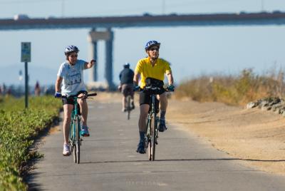
Levee Pedway
The Foster City Pedway/Bikeway next to Belmont Slough
The peninsula of Foster City is a planned community of nearly 30,000 that was built in the 1960's on the hayfields of former Brewer's Island. At the turn of the century, levees were built around mud flats here, which were dried and turned into farmland. Housing developments now surround a 200-acre artificial lagoon that winds through the center of the 4 square-mile city. Marina Lagoon, a now-tamed slough which used to empty into San Francisco Bay, borders Foster City to the west. The two lagoons are used for water recreation and stormwater runoff control. Pumps control the levels of the lagoons and herbicides are used to control vegetation. In contrast to the highly-controlled lagoons, to the southeast of the city is the mostly-natural Belmont Slough, which empties into the Bay. The Bay tides dramatically affect the level and appearance of the slough. The waters of San Francisco Bay itself wash the city's northeast to northern shores. Hwy 92 cuts diagonally through the city and leads to the San Mateo-Hayward Bridge. The outer edges of the city along Belmont Slough and San Francisco Bay are protected undeveloped marshland or bayfront, with public access. This is where the Bay Trail runs.
The Bay Trail here treads the boundary between the natural and the manmade. On one side of the trail, children play in playgrounds surrounded by manicured lawns behind their backyard fences. On the other side, spear-billed egrets wade in the pickleweed marshes probing the waters for food. Nearer the San Mateo-Hayward Bridge, cars hurry by along the road paralleling one side of the trail, while the wind-whipped waves of San Francisco Bay crash into the rocky shoreline on the other side.
Foster City's segment of the Bay Trail starts at the southwest corner of the city at the end of Marina Lagoon. It heads east and follows the winding path of Belmont Slough, which gets steadily wider as it approaches the Bay. The trail follows the bayshore around the edge of the city and eventually crosses under the San Mateo-Hayward Bridge to continue on towards San Mateo. The trail description below describes a 12-mile loop trip that begins in Redwood Shores, loops around the Bay Trail in Foster City, then returns along Marina Lagoon. Most of this trip is on dedicated paved multi-use paths and can be taken in about an hour or two by bicycle. The paths are smooth enough for roller skaters and baby strollers. Walkers and joggers can take shorter trips. The Bay Trail in Foster City is easily accessible at almost any point along the route from suburban neighborhood streets.
The Bay Trail connects to Redwood Shores to the south and San Mateo's bayshore parks to the north. The trail along this part of the Bay can be taken as an almost continuous path, with only a few short sections requiring on-street travel. It runs from Redwood Shores near the San Carlos Airport, around Foster City, and along the bayshore to just south of San Francisco International Airport in Millbrae.
